This week, satellite oceanographer Professor David Antoine, from Curtin’s School of Earth and Planetary Sciences, will co-lead a research voyage last undertaken in 1963.
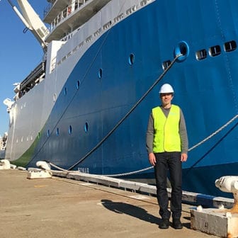
On 14 May, he and 30 other scientists will board the CSIRO research vessel Investigator in Fremantle and embark on a voyage to the eastern Indian Ocean. There, the research teams will spend a month gathering data on the area’s marine ecosystem, to determine its physical and biogeochemical changes and any connections to climate change.
Antoine’s project is contributing to the Second International Indian Ocean Expedition (IIOE-2) – a comprehensive UNESCO science program that’s providing new information about the Indian Ocean’s currents, marine ecosystems and influence on climate.
The IIOE-2 is a vital scientific endeavour, given that in the past 50 years the surface layers of the eastern Indian Ocean have warmed by more than a degree. Since it commenced in 2015, the program has enhanced our understanding about heat and mass transport in and around the Indian Ocean, which is vital for predicting climate variability and change.
Antoine’s focus, and that of his postdoctoral researcher Dr Charlotte Robinson, who will also be on board RV Investigator, is the living minutiae that have major impact on atmospheric carbon – phytoplankton.
The surface layers of the seven oceans are the kingdoms of the phytoplankton. Ranging in size from less than a micron to a millimetre or so, and despite their reputation for plainness, phytoplankton are among the most diverse group of microorganisms on Earth.
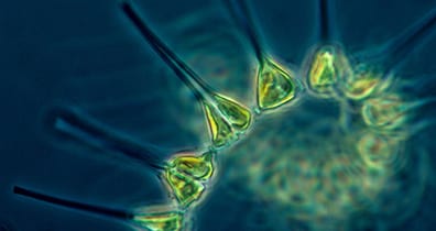
“Phytoplankton are responsible for consuming a large part of the planet’s atmospheric CO2 and transferring carbon to the ocean depths, and, ultimately, to the sediments of the sea floor,” Antoine explains.
“They’re a major part of what we call the biological pump. If phytoplankton were to decrease, atmospheric CO2 would increase.”
Every year, this floating community of photosynthesisers produces 50 billion tons of organic matter. Known as the oceanic primary production, it is the basis of the entire marine food web.
However, as Antarctic land-ice melts and changes the ocean’s temperature, composition and flow, the impacts of climate change on marine and terrestrial life all around the Indian Ocean basin will be increasingly intense.
As an oceanographer, one of Antoine’s main research interests is the long-term changes in ocean phytoplankton and primary production.
“Phytoplankton actually produce the same amount of organic matter produced by the sum of Earth’s terrestrial plants, when their biomass is less than one per cent of the biomass of terrestrial plants.”
Given the importance of phytoplankton, it is critical to have accurate data about their abundance and how they’re travelling, literally. But how to tally organisms in remote marine environments without constant sampling?
“Satellite technologies and bio-optical techniques,” he says.
In living colour
At Curtin, Antoine heads the Remote Sensing & Satellite Research Group. Their work centres on passive optical remote sensing, which interprets electromagnetic radiation (EMR) from the sun that is backscattered from the Earth to space.
Within this area, bio-optics is a relatively new science that studies the interactions between the EMR, as captured by satellite sensors, and absorbing and/or scattering substances of biological origin – such as phytoplankton.
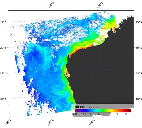
“Phytoplankton contain the pigment chlorophyll-a, which preferentially absorbs light in the blue part of the spectrum, so we can quantify their biomass from space by gauging the chlorophyll concentration from the ocean colour,” he says.
“Plus, each species has a specific assemblage of other pigments we can use to identify the various groups.”
He says such research capabilities are continuing to develop, in line with advances in satellite technologies.
“The launch in 1978 of the first satellite carrying an ocean colour sensor revolutionised the way oceanographers were seeing phytoplankton dynamics in the ocean.
“Remote sensing offers us uninterrupted data sets over the world oceans, and these data are increasingly used in scientific research and applications.”
What makes the Investigator voyage revolutionary for Antoine and his research team is that the last, and only, scientific voyage to the 110th meridian east was in 1963 – 15 years before the launch of the first satellite carrying an ocean colour sensor.
From Diamantina to Investigator
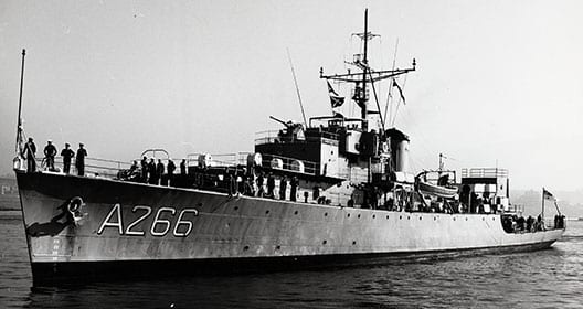
Between 1959 and 1965, the first hydrographic survey of the Indian Ocean was undertaken by international science teams from 14 countries, aboard 45 research vessels. The mission to explore the waters and seabed along 110°E was allocated to the Royal Australian Navy’s wartime frigate HMAS Diamantina.
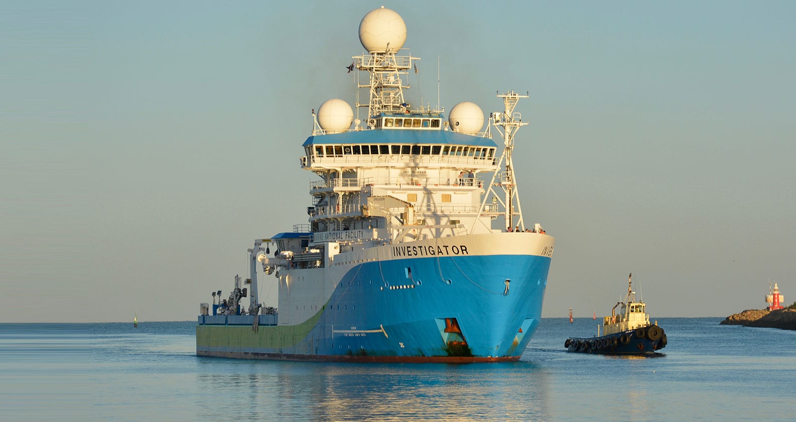
Now, scientists from around Australia and the world have arrived in Perth ready to board RV Investigator, which hosts $20 million worth of scientific instruments for oceanographic, geological, biological and atmospheric research.
After sailing from Hobart to collect the researchers and a comprehensive cargo of research equipment, the ship is now set depart Fremantle and reprise the pioneering 1963 voyage of Diamantina
Five years in the planning, the project is led by Chief Scientist Professor Lynnath Beckley, from Murdoch University, with Antoine as Deputy Chief Scientist. In addition to Murdoch and Curtin, 14 other Australian and international universities and organisations are contributing research teams to the expedition.
Supported by a grant from the CSIRO Marine National Facility for sea time on RV Investigator, the research is Australia’s key contribution to the IIOE-2. From Fremantle, the ship will head about 500 kilometres offshore before sailing due north, visiting 20 locations about 170 kilometres apart on the 110°E meridian.
The Copernicus connection
For the past three years, marine scientists have been scrutinising the world’s phytoplankton via the European Space Agency’s (ESA) satellite, Sentinal-3. Among its four sensing instruments is OLCI, the Ocean and Land Colour Instrument, which measures chlorophyll absorption.
However, like all machines, satellites suffer wear and tear; in situ studies are therefore necessary to recalibrate the sensor and validate its data – a process known as cal/val. Given the increasing impact of climate change on the world’s oceans, it stands to reason that regular in situ sampling is imperative.
ESA is therefore providing additional support for Antoine’s project with research funding, as the organisation looks to advance its cal/val activities and the application of marine bio-optic information ‘products’ derived from satellite observations.
“ESA contributes to the EU’s Copernicus program, which undertakes Earth observations for extensive research and monitoring purposes.
“The voyage will provide Copernicus with data for validation of its Sentinel-3 products. And, overall, the data we collect will lead to a better understanding of how the EMR signal forms.
“This will enable a scientific step-change, from short-term satellite missions to programs that can deliver accurate observations over many decades.”
These improved capabilities will inform studies across the range of earth sciences. They will also benefit many food-based industries; fishing and seafood are the obvious users, and Antoine expects to see a rapid increase in collaboration between researchers and industry in this area.