Satellite breakthrough
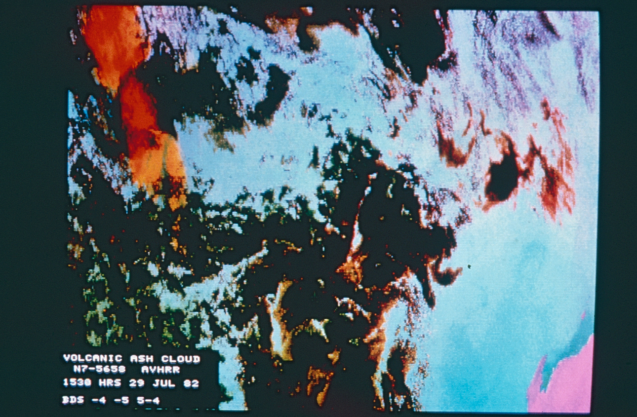
The above image from 1982 is of a large cloud of volcanic ash located somewhere between Australia and Indonesia.
The cloud resulted from an eruption of Mount Galunggung in Indonesia. Reported widely at the time (and since then), a British Airways aircraft flew into the cloud and almost crashed. The aircraft‘s four engines failed and required a restart before the plane could return to Indonesia. Aviation was disrupted in the region for some time as there was no way to distinguish the ash cloud from normal cloud activity.
WAIT and CSIRO scientists used dish antenna (previously installed by staff on the top of Civil Engineering and Electrical Engineering) to receive temperature information and imagery from the National Oceanic and Atmospheric Administration’s (NOAA) polar orbiting satellite. Working together they designed a computer program to identify the ash cloud and distinguish it from other normal cloud formations. This enabled aircraft already in the air to identify and navigate around clouds of volcanic ash.
The then Federal Minister for Science and Technology, David Thompson described the work of Dr Frank Honey, Head of CSIRO’s remote sensing group located at Floreat Park and Dr Bill Carroll, Head of WAIT’s Satellite Technology Centre as ‘ a brilliant piece of science, and a credit to the ingenuity of Australian scientists. ‘
His comments and a full story on the work of these scientists was published in the August 1982 WAIT Gazette and can be found here.
.
Related stories

Flashback to 1976
1976 saw an increase in student numbers and more degree level courses

The Great WAIT Scavenger Hunt
In late 1978, as part of Student Activities Week, the WAIT Student Guild organised The […]
The roaring 70s at Curtin: flashback to 1975
1975 was a year of consolidation at the Western Australian Institute of Technology (WAIT) (now […]

Archiving Binar-1 satellite mission artefacts
Earlier this year, the Archives recognised the significant nature of Western Australia’s first satellite mission […]